At last, tomorrow is the start of Ember’s and my long-awaited camping trip. I’m excited. She’s not. That’s what she told me, with her usual honesty, during a video chat last night. Eleni says Em alternates between anticipation and anxiety. She seems wary of leaving the familiarity of parents, sibs and pets. Indeed, they’ve been an exceptionally tight-knit unit during their isolation for the past 1.5 years of Covid. Their attachment to one other must have intensified. Homesickness never used to be an issue with her; she’s stayed with me on countless occasions and I even took her East with me a few years back. The times, they are a’changin’. So hard for little ones.
When I was twelve I took a two-and-a-half-day train ride from Paoli, Pennsylvania to Rock Springs, Wyoming for a five-week summer camp near Jackson Hole. Like Ember, as the departure date got nearer I was overwrought about leaving my parents. I was inconsolable. Yet the second I climbed aboard the train, all was forgotten and I was fine for my entire absence.
Two years later I made the same journey. This time, beforehand, I was confident, without a trace of that unbearable sensation of missing my parents. No problem at all. Until I boarded the train. From that moment, and for the full five weeks, I was in unrelenting and bitter despair pretty much every moment.
The moral of the story: perhaps dread pays off in the end.
I hope that once Ember and I get underway, she’ll settle into the spirit of the adventure. Of course I’ll do everything in my power to put her mind at ease. I’m even leaving my new camp-cot at home so that I can sleep right next to her on the ground.
Before I go, I’d like to show you those two animated-GIF maps that I’ve been building for a while. For each, I chose one subsection of a specific active northern California wildfire and followed its advance over a number of days, taking screen-grabs to keep tabs on the changes. Then I spent countless hours transforming them into moving images. Don’t ask me why. I can’t explain. Maybe it’s an unconscious strategy for processing the magnitude and tragedy of the crises. I dunno. In any case, I clearly have too much time on my hands.
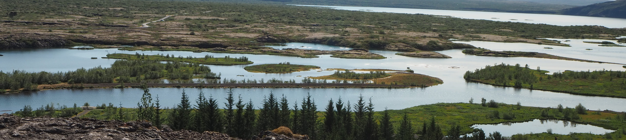
This first animation centers on the vicinity of Adams Lake and Coffee Creek in the Trinity Alps, an area of concern to me because that’s where we hiked a month ago, as you remember. When I began checking the San Francisco Chronicle’s online California Fire Map & Tracker, the region was a few miles from the source of the blaze, so initially it seemed to be safe. But before I figured out how to document all this, Adams Lake and environs had already been consumed, as was a portion of the scenic, potholed Coffee Creek Road (the wiggly purple line you’ll see) that we’d loved meandering along. At its dead-end was a nice campground above a river and, nearby, a beautiful lodge with cabins dotted around its acreage. I hoped that the fire wouldn’t devour more of that pretty, wooded road. It did. It appears that those places are destroyed now.
It’s painful to realize that the beauty we were lucky enough to enjoy is gone: giant ancient trees, a zillion wildflowers, meadows, and even that that little stand of alders where I lost my balance and gouged my arm on a branch while trying to leap across Adams Creek. At least I still have the tiny scar as a reminder of being there. Throughout our explorations we’d remarked on the vast quantity of dry fuel everywhere and the remoteness of the terrain, and worried about exactly this scenario. I can hardly bear to think about what those directly affected are experiencing.
So here it is: the progression of part of the River Complex Fire between August 17 and this morning. At the end, I’ve included three of the photos I took on our Adams Lake hike exactly a month ago, on July 22.
The second animation came into being while I was on the East Coast and monitoring the Dixie Fire from afar. It had been maybe 30 miles from Lassen National Park where, months earlier, I’d made camping reservations for Ember and me. We were supposed to head up there tomorrow. So I wanted to keep track to make sure it wasn’t getting any closer. On this map I’ve marked Summit Lake (the location of our campground) and Butte Lake (as an additional point of reference, and because it’s a friend’s favorite place to stay there). Then I proceeded to watch with horror as, day by day, the fire relentlessly approached, eventually breaching the park boundary.
At first it appeared that its continuing movement through Lassen might be thwarted; gradually, containment crept up to about 35 percent. But suddenly weather conditions went haywire and the blaze exploded. Containment plummeted to 21 percent and remained at that level as the fire spread in every direction. Before long it had razed some of the park’s historical landmarks as well as its natural splendor, not to mention the entire town of Greenville to the south and other communities. (Eleni just told me that Taylorsville near there has just been placed under mandatory evacuation orders as well.) This inferno is a disaster for so many, a draining, dangerous and discouraging challenge for those fighting it, and a great sadness for the rest of us.
Okay, here is the Dixie Fire’s growth between August 6 and today. As of this morning, it appears that the flames have indeed just reached the shores of Summit Lake.
I’ll be back to tell you all about our redwood journey—a hastily made Plan B when Lassen started to burn—when we return at the end of the week.
Devastating! But it looks as if they are beginning to be contained???
when toby came back from the river complex a couple of days ago, he was furious. he said they never fought the fire but did structure protection only. houses people refused to evacuate.
have a wonderful trip!